Contemporary New Zealand Geographic Issue
|
|
Watch the episode of Megacities: Living in the City to get an understanding of the impact large cities can have on people and the environment
Write a summary of the episode including 3 concepts. |
Contemporary means now or in the near future.
Geographic issue refers to a context that involves a concern, problem, debate or controversy related to a natural or cultural environment, which also includes a spatial dimension.
There are 4 parts to this topic:
1. The nature of the issue. This refers to the location of the issue (map) and the effects of the issue on the natural and/or cultural environment.
2. The viewpoints relating to the issue. This refers to the viewpoints for and against the issue and why the people/groups have that viewpoint AND how the viewpoints change over time.
3. Evaluation of the possible course of actions . This is where you give strengths and weaknesses of three possible actions to solve the issue.
4. Making a fully justified recommendation . This is where you decide which one is the best course of action to solve the issue and why.
|
WHAT IS URBAN SPRAWL?
Urban Sprawl is the spreading out of a city and its suburbs over more and more rural land at the periphery" Sprawl happens when people move in to the suburbs – often vast rural areas once home to wildlife and farms. |
|
|
|
|
|
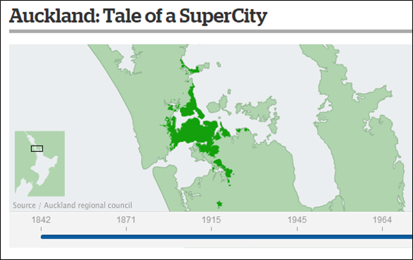
Where has Auckland Sprawled?
Use the interactive graphic on the growth of Auckland (link is below) to explain what Auckland was like in: 1842, 1871, 1915, 1945, 1964, 1975, 1987, 2008 Click here for the interactive map of Auckland's Growth |
|
History of Urban Sprawl in Auckland Click here to watch the video from class on Urban Sprawl in the 1960s |

|
Articles
Auckland: Boom Town
Moving to the Shore
Sprawling Southwards
Urban Sprawl not for Auckland
Auckland should expand
The Case for a compact city
The Auckland Unitary Plan: The Battle to Build the City we Deserve
Auckland Transport Blog
Special Housing Areas
Pokeno Village Estate
Warkworth
Waiheke Island
Helensville

|
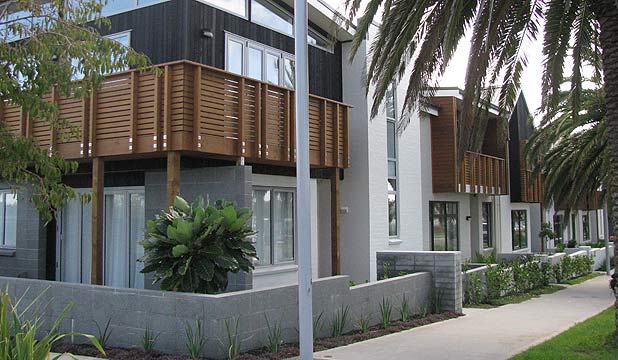
Hobsonville Point is an example of Medium Density Housing. You can read more about Hobsonville Point here.
|
|
Flat Bush
What is Flat Bush like? Click here to find out more.
What is Flat Bush like? Click here to find out more.
Stonefields
What is Stonefields like? Click here to find out more
What is Stonefields like? Click here to find out more
| |||
|
Building in Cities
|
| ||
Extra information
|
| ||||
|
| ||||
Other useful links
Additional links
The follow links provide information on Auckland’s forecasted population growth and perspectives on how to address the related issues.
http://www.stats.govt.nz/browse_for_stats/people_and_communities/geographic-areas/mapping-trends-in-the-auckland-region/summary.aspx– Statistics New Zealand.
The dying backyard dream – newspaper article about future real estate trends, May 9 2011 http://www.nzherald.co.nz/business/news/article.cfm?c_id=3&objectid=10724292.
Rail electrification not more urban sprawl in Auckland - http://www.scoop.co.nz/stories/PA0704/S00383.htm
Keeping Auckland's future bright - sustainable city development – information about Stonefields planned community www.stonefields.co.nz.
Assessment
Part A will be completed during class time and at home in your own time (Part A only goes to Achieved level). Part B will be completed over two and a half hours of class time. Your teacher will have told you those exact dates.
Part B is open book and you will be given an Resource booklet. if you want your own copy of the Resource booklet, you can download it below. You can not bring in new information once the assessment starts.
Part B is open book and you will be given an Resource booklet. if you want your own copy of the Resource booklet, you can download it below. You can not bring in new information once the assessment starts.
|
| ||||
